GST Viewer™
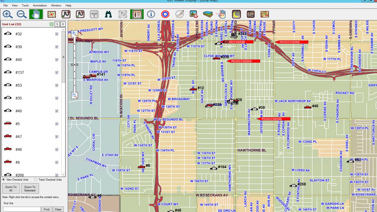
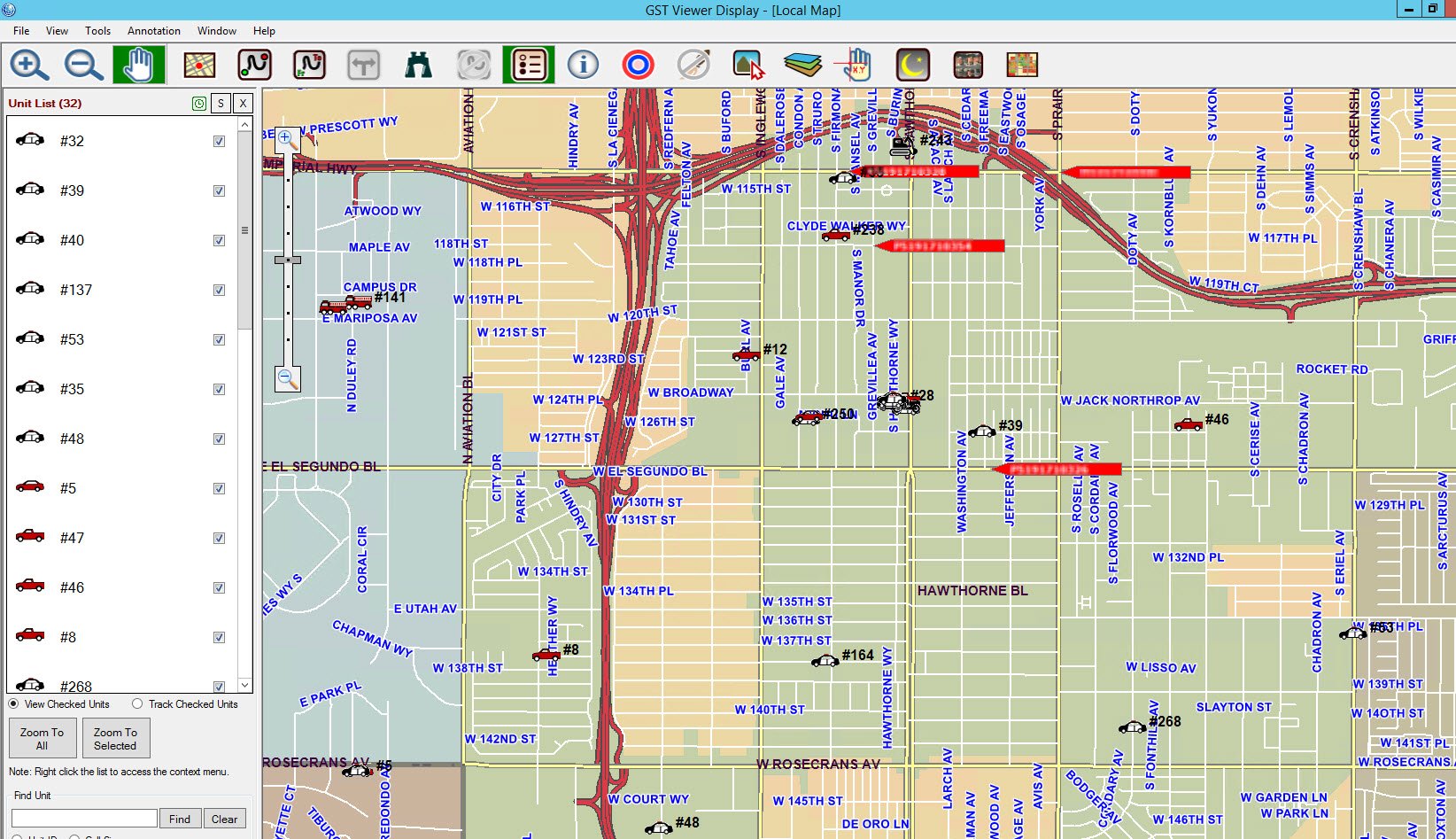
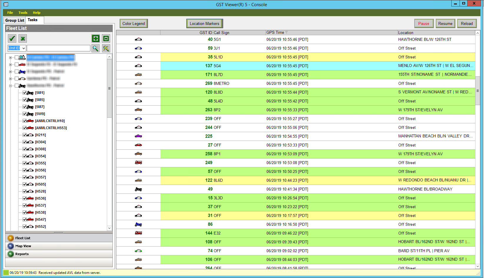
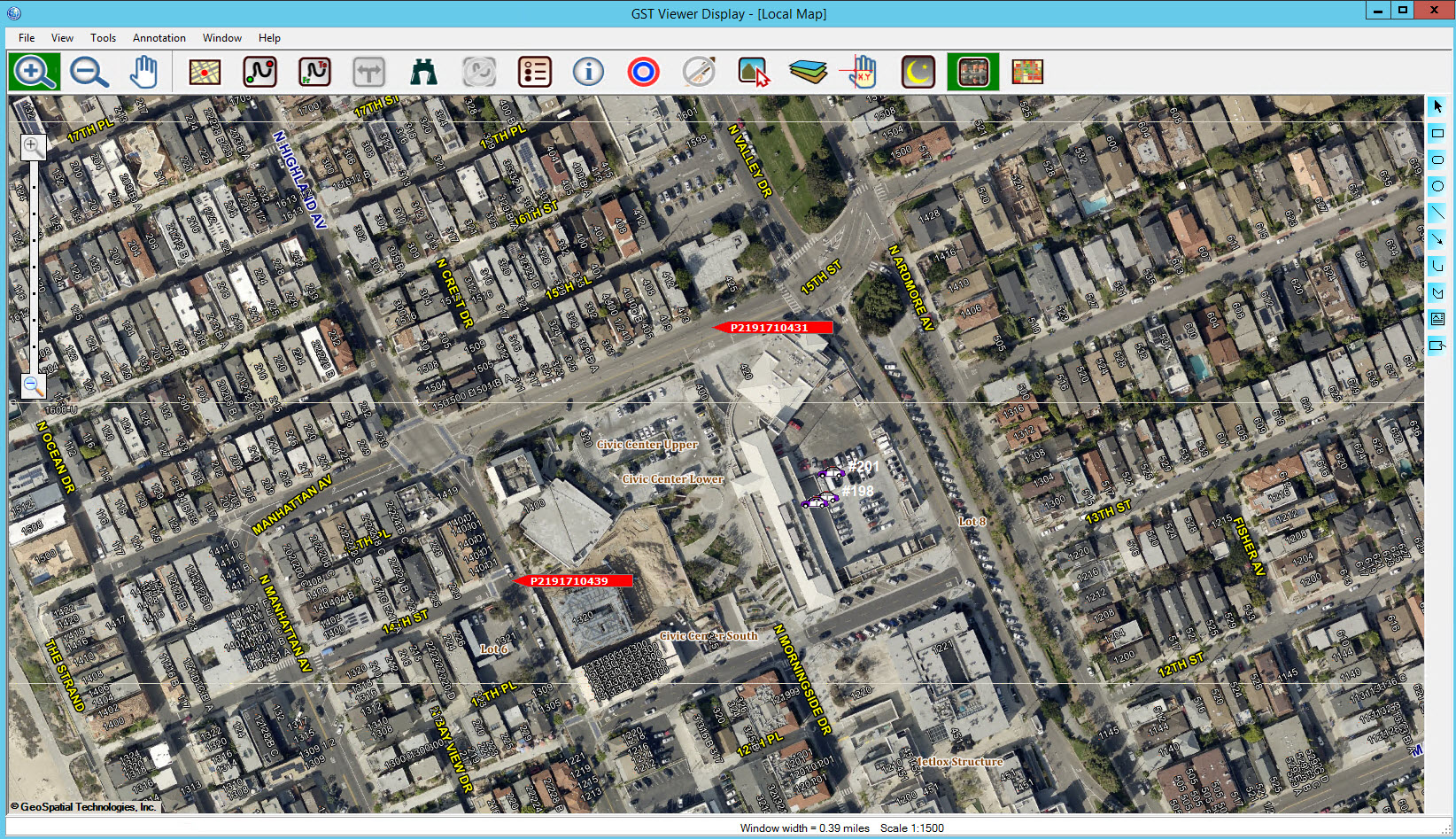
GST Viewer™ provides real-time tracking of GPS equipped assets. It combines the latest technologies in Geographic Information Systems (GIS), Global Positioning Systems (GPS), and wireless communication to empower dispatchers, watch staff, and management with real-time vehicle information and locations.
Features
Mobile Asset Tracking
Near Units Identification
Filters
Route Generation
Asset Identification
Map Display
Map Tools
Interoperability Function
Reports
Speed Alerts
(Optional)Optional Add-On Modules
GST Viewer™ E911 plots 911 calls onto the map, identifying cellular or landline calls via an interface between GST Viewer™ and any agency’s existing E911 equipment. This feature allows dispatchers to view 911 calls along with incident locations from CAD and available responding vehicles from AVL.
- Real-time mapping of 911 calls from landlines and cellular phones.
- PSAP Wireless ALI Format 04 Phase I and II.
- Differentiate 911 calls within and outside jurisdictions.
- Identify the nearest address to a wireless 911 call.
AVL-Based Proactive Policing
Real-Time Patrol View for law-enforcement agencies minimizes crime risks by employing the most effective patrol strategy. This module constantly monitors police presence throughout the jurisdiction based on real-time AVL data of law enforcement vehicles and highlights locations where additional patrol may be needed. Real-time Patrol View provides watch commanders and dispatchers with up-to-the-minute situational awareness and significantly enhances the effectiveness of proactive policing.
- Proactive policing based on real-time GPS data.
- View patrol activities throughout the jurisdiction.
- Identify areas requiring enhanced police patrol.
- Effective crime prevention through patrol strategy.
- Up-to-the-minute situational awareness for watch commanders and dispatchers.
- Optional GST Mapper® MDC mobile mapping software provides field officers with mission-critical information on a common operating picture.
Testimonial of Real-Time Patrol View (Chief Michael Ishii, Hawthorne PD, CA)